 THE NERC MST RADAR FACILITY AT ABERYSTWYTH
The Natural Environment Research Council (NERC) MST Radar Facility at Aberystwyth:
- was an atmospheric observatory that was operated on behalf of the UK's environmental science community between 1989 and 2024.
- has now ceased operations.
- was known as the National Centre for Atmospheric Science (NCAS) Capel Dewi Atmospheric Observatory between 2014 and 2024.
- was located at Capel Dewi (52.42°N, 4.01°W) near Aberystwyth in west Wales (UK).
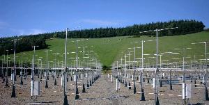
- was the home of a 46.5 MHz Mesosphere-Stratosphere-Troposphere (MST) wind-profiling radar.
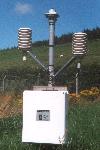
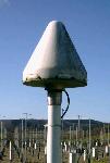
- operated a number of auxiliary instruments for measuring (amongst other things) surface met parameters, surface winds, and cloud base altitudes.
- hosted guest instruments on behalf of other groups.
Data from the facility's instruments remain openly-accessible through the Centre for Environmental Data Analysis (CEDA).
This website will be maintained in order to provide on-going access to information and resources associated with the facility.